dresden - MSc Topics

The aim of the master thesis is to investigate to what extent the Web Content Accessibility Guidelines by W3C are considered in the state-of-the-art of scientif
The aim of this thesis is advance the state of the art of online geovisualization search

Graphic recognition results in class-specific pixel masks calling for transformation into polygons and polylines.
")
The aim of the master thesis is to explore the possibilities of using generative text-to-image diffusion to present one and the same dataset with different emot
Producing analytics on multidimensional settlement characteristics (intensity, size, access) for evidence-based policy making.
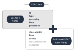
The implementation of a STAC wrapper will be conceptualised, implemented, demonstrated and evaluated.
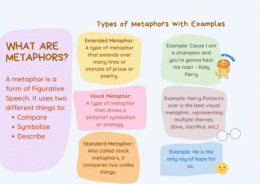
This thesis will use existing taxonomies of image schemas to annotate people’s actions during map interaction and build a tool that help make sense of the metap
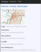
This thesis will explore means of addressing the gap in automated metadata generation for maps.
The aim of this thesis is to shed some light on that lead to a positive experience with geodashboards.
")
In the master's thesis, an LSTM autoencoder model is to be developed for the displacement of linear objects using Python and Tensorflow.