Cartography – MSc Topics

To develop interactive maps at different scales (spatial, temporal, and spectral) highlighting the condition and the factors that produce stress in plants resul

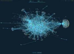
Artifical Intelligence (AI) revolutionizes many aspects of our digital world. However, the “blackbox” AI might lead to an impact on how users trust maps.
Artifical Intelligence (AI) revolutionizes many aspects of our digital world. However, the “blackbox” AI might lead to an impact on how users trust maps.
Artifical Intelligence (AI) revolutionizes many aspects of our digital world. However, the “blackbox” AI might lead to an impact on how users trust maps.
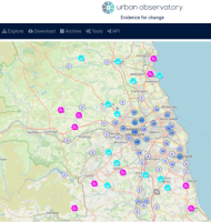
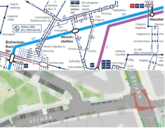
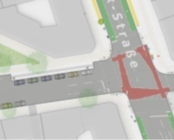
Assess the usability and value of portraying multi-dimensional, large volume, sensor-derived, dynamic urban data.

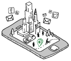
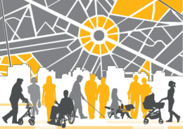
Research if and how maps can be used to help people make sustainable decisions about travelling.

Graphic recognition results in class-specific pixel masks calling for transformation into polygons and polylines.
The goal of this thesis is to develop a spatial mapping approach for slums toward SDG 11 using urban morphology and topology technique.

The goal of this thesis is to explore and identify the risk factors of active mobility in urban environments with multi-source data, extract the knowledge there
This thesis will use existing taxonomies of image schemas to annotate people’s actions during map interaction and build a tool that help make sense of the metap
In the coming decades, cities will be among the main areas where the transformation towards a more sustainable society has to take place.

To analyze user editing patterns, e.g., user focus of geospatial extent, editing frequency.
")
Investigate the potential of notebooks for cartographic education.
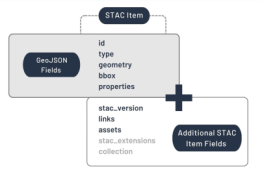
The implementation of a STAC wrapper will be conceptualised, implemented, demonstrated and evaluated.
.")
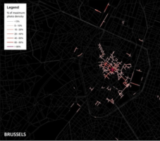
The goal of this thesis is to quantify the perceived complexity and cognitive load caused by virtual symbol and label density and evaluate their influence on th

Research the use of vector tiles for base layers in thematic mapping.
")
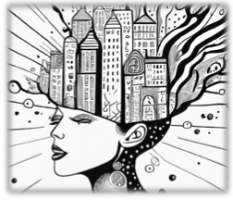
The aim of the master thesis is to explore the possibilities of using generative text-to-image diffusion to present one and the same dataset with different emot
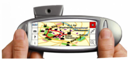
Modern smartphone displays have the potential to display highly detailed maps with intricate symbology.

Undertake a survey of NMAs to determine recent changes in products and interaction with the open source community.
The goal of this research is to a) re-implement two or more classic studies from cartography using modern digital tools; b) to attempt to replicate the findings
The aim of the master thesis is to investigate to what extent the Web Content Accessibility Guidelines by W3C are considered in the state-of-the-art of scientif
To design and and implement an approach that allow the use of annotations in both paper and online atlases use the strengths of both media.
Human perception and cognition does not supply the map-reader with objective measurements of the visual field, but incorporate various information-processing st
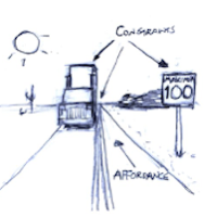
In this thesis eventual differences in the action possibilities of using maps based on the affordances of maps in different media should be analyzed.

The goal of this thesis is to establish a visualization pipeline for pre-classified point clouds in order to make visual representations of LiDAR data easily un

To build an AR or VR application that allows users to explore a generalized 3D origin-destination flow map by having grouped routes “exploded” (i.e., disaggrega

To learn a map generalization model for building footprint simplification and aggregation with deep learning, and to proper encode and learn polygon geometries
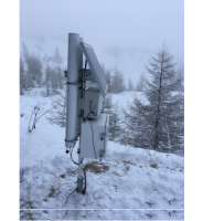
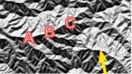
To develop a semi-automatic mapping tool able to calculate the snow cover fraction area at a small scale.

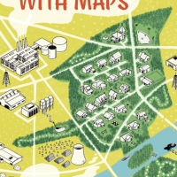
What maps do we need in order to support the concept of the 15-minute-city? This project can be developed in one of several directions.

The goal of this thesis is to investigate the impact of label placement in mixed reality environments, identifying optimal strategies that enhance spatial knowl
The aim of this MSc research project will be to develop a system that makes it possible – depending on a given combination of data types and/or on a given type
Academic education of the fundamental concepts and methods of cartography is usually done in the class room, often by frontal lectures.

PPGIS data is increasingly collected understand location-specific human values, perceptions, behavior, and preferences for future land use and development.
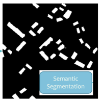
Develop and evaluate an instance segmentation approach for the extraction of area features from historical map scans and investigate the scalability.
It is widely accepted that information published online should be accessible to potential users with perceptual, cognitive or physical limitations (Kim et al.,
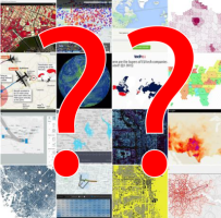
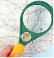
The aim of this thesis is advance the state of the art of online geovisualization search

An orthographic view of a globe is a relatively undistorted view of Earth's geography, but the whole surface cannot be seen synoptically at once: the viewe

develop conceptual models and practical examples for the implementation of a City Energy Performance Dashboard in the contextual background of energy transition
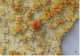
Producing analytics on multidimensional settlement characteristics (intensity, size, access) for evidence-based policy making.

Implementing and testing modifications to existing cartographic means with respect to their ability to tell stories.
People pay attention to space around them, however, what we focus on depends on our situation, mood, background and reason for which we interact with space.
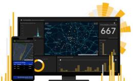
The aim of this thesis is to shed some light on that lead to a positive experience with geodashboards.
, Geography and Map Division, Library of Congress")
In this topic, the possibilities and limitations of the influence of new AI solutions will be examined and researched in order to support and promote cartograph
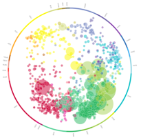
The objective of this MSc topic is to devise a method to visualise expertise of people in the specific domain of geoscience.

This thesis aims to incorporate visual effects to facilitate depth perception in Mixed Reality (MR).
This thesis will explore means of addressing the gap in automated metadata generation for maps.
")
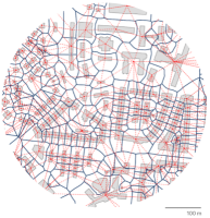
In the master's thesis, an LSTM autoencoder model is to be developed for the displacement of linear objects using Python and Tensorflow.