Accessible & Inclusive Cartography – Developing a conceptual framework and map design guidelines
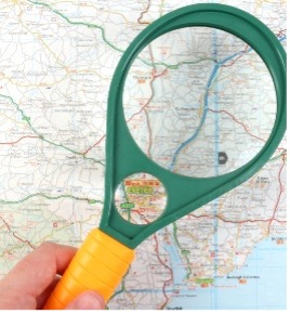
 Maps come in a wide range of designs, from densely packed multi-purpose maps, to colorful thematic maps, to maps designed specifically for blind and visually impaired people. Can we estimate what proportion of the population is included or excluded by specific design choices? Can we provide clear and actionable guidelines for map designers for how to create more inclusive maps?
Objective:
Keywords:
Description:
Previous work on accessible map design has primarily focused on providing alternative representations for users who are blind or have very low vision (Miller, 2017). However, instead of discrete (legal) categories of disability, the ability and skills of the overall population can be thought be a continuum, and therefore any map design that approaches the limits of perceptual or cognitive ability will exclude a certain proportion of the population. With modern display devices approaching the visual fidelity of printed media (Ledermann, 2023), more detailed map designs have again become feasible, and thus the question becomes relevant: what percentage of the demographics will be able to reliably read a given map, and what impact would changes in the design have on the overall accessibility of the map?
Tools like Chartability (Chartability, 2020; Elavsky et al., 2022) or WhoCanUse (WhoCanUse, 2020) allow designers to assess websites and data visualizations and derive an estimate for which percentage of the population will be able to make use of a particular design. The results of the thesis should allow for the creation of a similar tool, tailored to the needs and questions of cartographers.
Skills required for the project
An interest in the topics of accessibility and social inclusion is required, as well as an interest in theoretical aspects of cartography as well as applied map design. The technology for realizing the case study can be chosen freely.
Your tasks
- Research of the scientific literature related to the topic
- Develop a taxonomy of aspects of accessibility and inclusion
- Develop a model that allows map designers to estimate how many and which users are excluded by a particular map design, based on existing scientific findings
- Optionally: implement an online tool similar to whocanuse.com, tailored to map design aspects
- Implement a map design case study (topic and area of the map can be freely chosen) and assess the developed framework in a small qualitative study
- Analyze the results
- Write the thesis
Staff working in this domain
Florian Ledermann (florian.ledermann@tuwien.ac.at)
References:
Chartability. (2020). Chartability Website. https://chartability.fizz.studio/
• Elavsky, F., Bennett, C., & Moritz, D. (2022). How accessible is my visualization? Evaluating visualization accessibility with Chartability. Computer Graphics Forum, 41(3), 57–70. https://doi.org/10.1111/cgf.14522
Ledermann, F. (2023). Minimum dimensions for cartographic symbology – history, rationale and relevance in the digital age. International Journal of Cartography, 9(2), 319–341. https://doi.org/10.1080/23729333.2023.2165218
• Miller, G. (2017, January 18). A Tactile Atlas Helps the Blind “See” Maps. National Geographic. https://www.nationalgeographic.com/culture/article/new-tactile-map-of-swiss-alps-for-the-blind
• WhoCanUse. (2020). WhoCanUse Website. https://whocanuse.com
• World Bank. (2013). Inclusion Matters: The Foundation for Shared Prosperity. Washington, DC. https://doi.org/10.1596/978-1-4648-0010-8
Kim, N. W., Joyner, S. C., Riegelhuth, A., & Kim, Y. (2021). Accessible Visualization: Design Space, Opportunities, and Challenges. Computer Graphics Forum, 40(3), 173–188. https://doi.org/10.1111/cgf.14298
Domain(s):
Study Program(s):
- MSc. Cartography (EXCLUSIVELY externally advertised)